Many workers’ roles have changed and evolved with the adaptation of emerging technologies. Inspectors, who are responsible for the conditional assessment of critical infrastructure like power grids, are no different. A virtual inspection is an inspection conducted while being physically away from the asset, meaning that virtual inspections leverage technology to fill the physical gaps. The inspector is still a human being, but safely distanced from the equipment. Let’s look at the role of the virtual inspector. We have summarized 6 main points on what differentiates the role of a virtual inspector.
1. Inspection at a desk
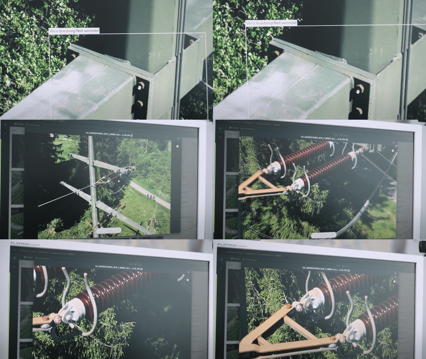
The role of a virtual inspector is to conduct the grid inspection at a desk using inspection software. With this type of inspection, they do not need to physically go and visit the asset. Software that has built-in inspection workflow can provide consistency and objectivity and provide the inspector with the business rules required to conduct the inspection based on the utilities standards and defect catalogue.
2. Images substituting for reality
The virtual inspector leverages visual data; images – captured out in the field for the virtual inspection. The images need to give the inspectors a full 360o view of the asset, as the visual inspection is a substitute for physically examining the assets.
If your image-capture methodology is not right you could end up giving the inspector too many images to view per asset, duplication or poor-quality images that makes it near impossible to identify defects and makes the inspection method inefficient.
3. Assistance by Artificial Intelligence
Most people have probably experienced the feeling of being overwhelmed and bored when performing a monotone task repeatedly. Imagine manually processing and linking 100 000 images to the correct asset, putting in the right coordinates and the relevant asset information. Pretty boring, right?
Artificial Intelligence can change that. An AI assistant will not get tired of doing repeatable tasks at scale, it is what it does best. By leveraging purpose-built AI software, virtual inspectors do not have to spend time on processing and linking images to assets manually, the AI will do it automatically. AI can also automate inventory and make a first pass at defect detection enabling the inspector to focus on high value tasks and save valuable time.
4. More time to conduct the inspection
With a virtual inspection the inspector can really take their time and view the asset structure from top to bottom and potentially identify more defects than when out in the field. When in the field you are going from asset to asset in different weather conditions and terrains. Here you are at the comfort of your desk and can zoom right into an asset.
5. Inspection reporting
No longer do inspectors have to manually note down defects or produce an inspection report. Inspection software can provide inspection reporting automatically and advanced software can also provide APIs into your core systems and automate your inspection results. This means that the inspector just has to focus on the task at hand: conducting the visual inspection.
Final thoughts
With skills shortage in the industry, tightening of budgets and needing to get more out of existing infrastructure, grid operators need to evaluate and adopt new strategies, technology and methodologies to their inspection programs.
Virtual inspections are an effective way to conduct routine inspections and can provide utilities with an additional tool in their inspection tool box. It also means that experienced inspectors can focus on high value tasks, where their skills and experience make a true difference.
We provide a flexible approach to virtual inspections, from working with customers to train their own inspectors to providing full end-to-end inspection services.
Thinking of making the transition? Contact us today!
Repower produziert und verteilt Strom an mehr als 48’000 Kundinnen und Kunden in der Schweiz und hat sich mit eSmart Systems zusammengetan, um ihren Netzinspektionsprozess zu digitalisieren und zu automatisieren. Das Programm wird die Softwarelösung Grid Vision® von eSmart Systems nutzen, die den gesamten Inspektionsworkflow mit KI unterstützt und gleichzeitig digitalisiert.
- Umstellung der Netzinspektionen von Repower von manuell auf automatisiert mit KI.
- Die KI-gestützte Software von Grid Vision wird verwendet, um ihr Hoch- und Mittelspannungsnetz zu inspizieren.
- eSmart Systems wird im Rahmen der Partnerschaft Inspektionsdienstleistungen für die Freileitungen der Repower AG erbringen.
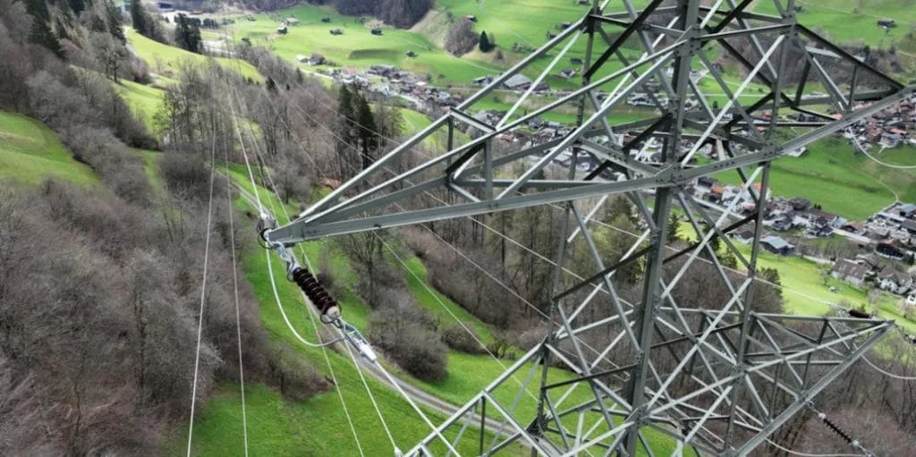
Diese Partnerschaft wird es Repower ermöglichen, sicherere, genauere und effizientere Inspektionen durchzuführen, die einen besseren Einblick in ihr Hoch- und Mittelspannungsnetz bieten, um ihre Asset-Management-Strategien für Netzstabilität und -zuverlässigkeit zu unterstützen. Damit wird Repower gewappnet sein, den wachsenden Ansprüchen an das Netz zu genügen und den Übergang zu einer kohlenstoffarmen Erzeugung zu unterstützen.
Die Energiewirtschaft steht vor besonderen Herausforderungen wie der Reduzierung von Risiken in der Stromversorgung und der Verbesserung von Netzplanungsprozessen, um nur einige zu nennen. Repower schätzt die Vorteile von Grid Vision, um nicht nur Effizienzgewinne in unseren täglichen Inspektionsprozessen zu erzielen und eine höhere Qualität zu erreichen, sondern auch, um tiefere Einblicke in unsere Assets zu erhalten. Dies unterstützt uns bei der Verwaltung von mittel- und langfristigen Wartungsplänen und unserer Investitionsstrategie.
eSmart Systems wird das Programm als Inspektionsdienstleistung anbieten. Hierbei werden Drohnen für die Bilderfassung mit automatisierten Flugmustern eingesetzt, um sicherzustellen, dass die Datenpräzision und -Konsistenz, sowie die Arbeitssicherheit gewährleistet und optimiert wird.
Die Inspektion der Repower Freileitung wird mittels der KI gestützten Software Grid Vision, durchgeführt. Die Inspektionsergebnisse werden innerhalb der Grid Vision aufbereitet und digitalisiert. eSmart Systems wird zusätzlich einen regionalen Drohnenbetreiber für die Bildaufnahme mittels automatisierter Flugmuster schulen.
Repower hat das klare Ziel, die Inspektion ihres Freileitungsnetzes und die Asset Daten zuoptimieren, um die Widerstandsfähigkeit ihres Netzes zu unterstützen. Wir freuen uns, Teil ihrer Reise zu sein, und freuen uns darauf, die Effizienz und Digitalisierung von kritischen Infrastruktur-Inspektionen für Repower zu steigern.
Über eSmart Systems
eSmart Systems ist ein führender Anbieter von KI-gestützten Lösungen für die Inspektion und Wartung kritischer Infrastrukturen. Mit unserer Softwarelösung Grid Vision revolutionieren wir die Art und Weise, wie Versorgungsunternehmen Übertragungs- und Verteilungsnetze betreiben und warten. eSmart Systems bietet einen datengesteuerten und zustandsbasierten Ansatz für Infrastrukturinspektionen, der von einer einzigen Plattform aus verwaltet werden kann. Wir unterstützen Unternehmen weltweit, indem wir für reduzierte Kosten, sicherere Inspektionen und eine längere Lebensdauer der Anlagen sorgen.
Über Repower
Repower ist ein international tätiges Energieversorgungsunternehmen mit operativem Hauptsitz in Poschiavo. (Graubünden, Schweiz). Repower ist seit mehr als 100 Jahren als Stromerzeugerin, Verteilnetzbetreiberin und Energiehändlerin tätig. Die wichtigsten Märkte sind die Schweiz und Italien.
Repower baut, betreibt und unterhält Verteilnetze, Unterwerke, Trafostationen, Verteilkabinen und Versorgungsleitungen bis zum Hausanschluss im Prättigau/Rheintal, im Engadin und in der Surselva. Die Gesamtlänge des von Repower verwalteten Netzes beträgt rund 3’000 Kilometer.
eSmart Systems, a global leader in AI-based solutions for inspection and maintenance of critical energy infrastructure, signs a contract with Alliander, to increase safety and optimize asset utilization within their existing energy network.

The contract, with a minimum value of 10 million euro, covers an Inspection as a Service (IaaS) solution for Alliander, one of the largest energy network distributors in The Netherlands.
The AI-supported service includes a full image-based digital inventory of all Alliander’s ~60.000 substations and cable cabinets, used to secure full regulatory compliance and safety to the public for all of their assets.
Die Energiewirtschaft steht vor besonderen Herausforderungen wie der Reduzierung von Risiken in der Stromversorgung und der Verbesserung von Netzplanungsprozessen, um nur einige zu nennen. Repower schätzt die Vorteile von Grid Vision, um nicht nur Effizienzgewinne in unseren täglichen Inspektionsprozessen zu erzielen und eine höhere Qualität zu erreichen, sondern auch, um tiefere Einblicke in unsere Assets zu erhalten. Dies unterstützt uns bei der Verwaltung von mittel- und langfristigen Wartungsplänen und unserer Investitionsstrategie.

eSmart Systems’ AI-supported software will enable Alliander to analyse technical conditions, predict and improve their asset management processes, including maintenance of its infrastructure assets over time. The solution provides Alliander with improved quality of their asset data of their distribution network, which will further unlock value in terms of capital spending, lowering carbon footprint, improving risk management including compliance with safe-to touch regulation.
eSmart Systems’ customer portfolio includes several of the world’s largest energy companies, such as Statnett, Naturgy, Xcel Energy and E.ON. With this new contract the company expects to both double its annual revenue and ramp up its global recruitment initiatives.

Repower hat das klare Ziel, die Inspektion ihres Freileitungsnetzes und die Asset Daten zuoptimieren, um die Widerstandsfähigkeit ihres Netzes zu unterstützen. Wir freuen uns, Teil ihrer Reise zu sein, und freuen uns darauf, die Effizienz und Digitalisierung von kritischen Infrastruktur-Inspektionen für Repower zu steigern.
About eSmart Systems
eSmart Systems is a leading provider of AI-powered solutions for the inspection and maintenance of critical infrastructure. We are headquartered in Halden, Norway and serve around 50+ utilities globally.
With our Grid Vision® portfolio, we provide Inspection Management and Asset Information Management solutions and services to utilities globally. Grid Vision provides a data-driven and condition-based approach to infrastructure inspections and support utilities to reduce inspection costs, improve inspection safety, improve the quality of asset data and prolong asset life.
About the Alliander Group
Alliander group is responsible for distributing gas and electricity to 3.2 million homes and businesses in the Netherlands. We operate 90.000km electricity grid and a 40.000km gas network across six regions including Amsterdam, Flevoland, Friesland, Gelderland, North Holland and South Holland.
We are committed to running a reliable energy supply to ensure that living, working and travelling remain viable in the future by developing sustainable grid technologies, innovative metering solutions and intelligent energy infrastructures. We take great pride in our networks being among the world’s most reliable. Our 7.000 colleagues make sure the lights are on, homes are heated, and businesses can keep operating.
A virtual inspection is an inspection that is carried out remotely away from the physical asset. Normally at a desk. The asset in this case is the power line, this includes the structure, components on and between the structures including the conductor cables. The virtual inspection is carried out by a subject matter expert who conducts a visual inspection of the assets. We have summarized the most common questions we get asked below.
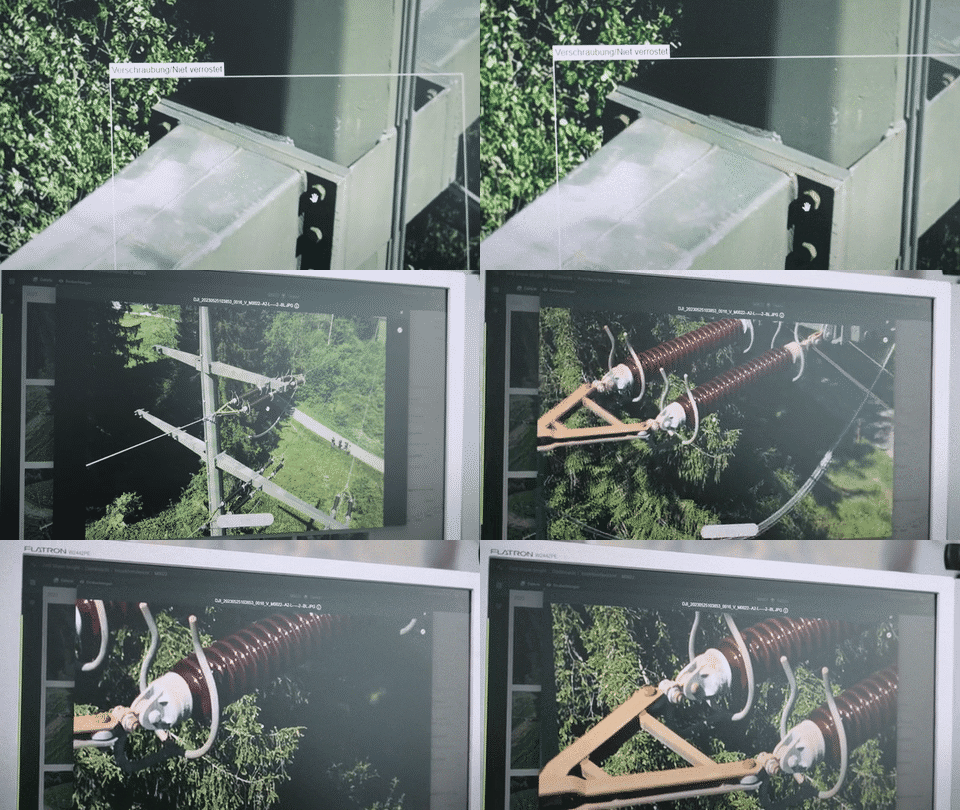
Why would I consider changing my inspection methods?
Traditionally, grid inspections are conducted by engineers out in the field on foot, on a pair of skis, by helicopter or other means of transportation. To get close enough to be able to examine the assets, it is necessary to climb towers and get closer to critical equipment than most of us would be (and should be) comfortable with. Not only are these methods very dangerous and physically demanding for the brave individuals who work in the field, it is also time-consuming, subjective and inefficient for the grid operators.
What types of inspections can you do virtually?
A virtual inspection can be performed for routine and detailed inspections. It is a process change where you are removing the inspection from being conducted out in the field to being conducted from behind a desk.
What types of data are used in a virtual inspection?
In this type of inspection, the subject matter expert can use images from still photography but can also use video, 3D reconstructions, infrared, LIDAR and UV sensor data.
Which infrastructure can a virtual inspection be applied to?
For grid inspections a virtual inspection can be applied to High Voltage(HV), Medium Voltage(MV) and Low Voltage(LV) power lines.
How is the data captured for a virtual inspection?
There are various methods for collecting data for a virtual inspection and the technologies and methods are growing each day. Currently, image capture most typically is performed by unmanned aircraft (drones), but can also include helicopters, vehicles, and ground crew with mobile devices. The method is dependent on the utility’s strategy, budget, terrain of the grid and regulations.
How is the inspection conducted?
There are various methods that utilities globally are adopting. The method and tools you use are dependent on budget, strategy and your end goal. Below are examples of how different utilities are conducting virtual inspections:
- View the captured data on their PC, manually looking for any defects based on a defect catalogue.
- Building in-house customized solutions to support the viewing of images and identifying defects.
- Using out of the box inspection software ranging from basic platforms for viewing images to advance inspection software with built-in inspection workflow supported by AI.
Does a virtual inspection replace routine and detailed inspections?
No! A virtual inspection is another method in your inspection toolbox and does not replace all inspection methods due to various factors including:
- Perspective of the image taken may not show certain defect types on the structure.
- Certain inspections can only be done in-person, for example checking foundations of structures or checking for rot.
- Currently you cannot accurately measure from just an image. But there are new technologies being developed to enable this.
Questions you should be asking when transitioning to virtual inspections
We know how difficult it can be to know what questions to ask when speaking to a vendor or your in-house team when considering the transition to virtual inspections. So we have made a list of things that get missed:
- Have you got the right data capture methodology?
- Will the images you capture work for the software you are using and for the virtual inspector?
- Have you got the right virtual inspection software?
- How will you process all the images you capture?
- Can you utilize your inspection results beyond the inspection?
- What is your strategy for the visual data you are collecting in the field? If you are collecting and paying for it, you should be using it.
- How will you future proof your investment?
Final thoughts
If you apply a virtual inspection to just replace your routine inspection cycle that is a great start and will definitely improve your safety, and give you a great inspection report. You can repeat and rinse this method over and over but it is still based on time and you would be missing out on the bigger return on investment.
If you involve your wider asset management team from the beginning and focus on linking the program to your overall process and the flow of visual data, you will see a bigger return on the program. Doing it right can see you transition from time-based to risk-based inspections and key decision making. If you are investing in collecting data in the field, make it count and work for your business.
If you would like a discussion with our experts on AI or how it can be applied to your inspections, contact us today!
Norske eSmart Systems, en global leder innen AI-baserte løsninger for inspeksjon og vedlikehold av samfunnskritisk infrastruktur, har signert en kontrakt med Alliander. Oppdraget har som formål å øke sikkerheten og optimalisere utnyttelsen av Allianders eksisterende strømnett i Nederland.
Kontrakten, som har en minimumsverdi på 120 millioner kroner, omfatter tjenester med tilhørende programvare for inspeksjon av distribusjonsnettet til Alliander, en av de største energileverandørene i Nederland.
Die Energiewirtschaft steht vor besonderen Herausforderungen wie der Reduzierung von Risiken in der Stromversorgung und der Verbesserung von Netzplanungsprozessen, um nur einige zu nennen. Repower schätzt die Vorteile von Grid Vision, um nicht nur Effizienzgewinne in unseren täglichen Inspektionsprozessen zu erzielen und eine höhere Qualität zu erreichen, sondern auch, um tiefere Einblicke in unsere Assets zu erhalten. Dies unterstützt uns bei der Verwaltung von mittel- und langfristigen Wartungsplänen und unserer Investitionsstrategie.
eSmart Systems skal levere en fullstendig, bildebasert, digital anleggsoversikt over Allianders nærmere 60.000 nettstasjoner og kabelskap. Det vil gjøre det mulig for selskapet å analysere tekniske forhold, forutsi og forbedre prosesser for forvaltning av strømnettet, inkludert vedlikehold, samtidig som det kan bidra til lavere kapitalutgifter og en reduksjon av karbonavtrykket.
– Vi er utrolig stolte av å få arbeide med et teknologidrevet foregangsselskap som Alliander. Gjennom dette samarbeidet får vi vist frem hvordan våre konkurransefortrinn innen AI-drevet programvare, teknologisk innovasjon og unike tjenestetilbud kan støtte avgjørende nettvekst, samt tilføre bærekraftig verdi til våre kunder, sier Henrik Bache.
eSmart Systems, som blant annet har Nysnø Climate Investments, Equinor Ventures og Kongsberg Gruppen inne på eiersiden, har fra før en kundeportefølje som omfatter flere av verdens største energiselskaper, deriblant Statnett, Naturgy, Xcel Energy og E.ON.
Med denne kontrakten forventer selskapet tilnærmet å doble sin omsetning i 2024, samt styrke organisasjonen på tvers av landegrenser.
Repower hat das klare Ziel, die Inspektion ihres Freileitungsnetzes und die Asset Daten zuoptimieren, um die Widerstandsfähigkeit ihres Netzes zu unterstützen. Wir freuen uns, Teil ihrer Reise zu sein, und freuen uns darauf, die Effizienz und Digitalisierung von kritischen Infrastruktur-Inspektionen für Repower zu steigern.
Om eSmart Systems
eSmart Systems er en ledende leverandør av AI-drevne løsninger for inspeksjon og vedlikehold av kritisk infrastruktur. Selskapet har hovedkontor i Halden i Norge og har mer enn 50 kunder globalt.
Med programvareløsningen Grid Vision® revolusjonerer selskapet hvordan strømleverandører driver og vedlikeholder sine nett. Grid Vision®er en digital plattform for virtuell inspeksjon av strømnettet på en langt mer effektiv måte enn historisk metodikk. Plattformen sikrer også datakvalitet og lagring av tilstandsvurderinger. eSmart Systems hjelper bedrifter over hele verden med å forbedre datakvalitet, redusere kostnader, forbedre sikkerhet gjennom sikrere inspeksjoner og bidra til lengre levetid for samfunnskritisk infrastruktur.
Om Alliander Group
Alliander-gruppen er ansvarlig for distribusjon av gass og elektrisitet til 3.2 millioner hjem og bedrifter i Nederland. Vi driver 90.000 km elektrisitetsnett og et 40.000 km gassnettverk i seks regioner, inkludert Amsterdam, Flevoland, Friesland, Gelderland, Nord-Holland og Sør-Holland. Vår forpliktelse er pålitelig energiforsyning for å sikre at det å bo, jobbe og reise forblir bærekraftig i fremtiden. Det gjør vi ved å utvikle bærekraftige teknologier, innovative måleløsninger og intelligent energiinfrastruktur. Vi er stolte av at nettverkene våre er blant verdens mest pålitelige. Våre 7.000 kolleger sørger for at lysene er på, hjemmene er oppvarmet, og at bedrifter kan fortsette sin virksomhet.
Grid operators have been inspecting their critical infrastructure using proven methods for years, but with a skill shortage in the industry, tightening of budgets and need to get more out of existing infrastructure, grid operators need to evaluate and adopt new strategies, technology and methodologies.

Limitations with current grid inspection methods
Traditional grid inspection methods can demand heavy machinery and a significant workforce on foot patrol or by helicopter. These inspection methods are established and work but are time consuming, manual, labour intensive, dangerous and can be subjective.
The majority of traditional inspection methods tend to be reactive with a find-and-fix approach and most methods are lacking digital documentation and automation within the process. On top of it, these methods are often just focused on capturing data for high priority defects and are prone to human bias and subjectiveness.
How can AI-assisted virtual inspections help grid operators?
AI-assisted virtual grid inspections can support grid operators in addressing some of these challenges and if done right can be an important inspection method in their toolbox. AI-assisted virtual inspections can support grid operators to:
1. Reduce cost and improve safety with less people out in the field, walking the line, climbing structures, or flying helicopters. Virtual inspections can minimize the risk of worker accidents by keeping people out of harm’s way as the asset data can be captured in a safe manner, distanced away from the physical structure using high quality camera technology.
2. Improve consistency and objectivity of inspections with a built-in inspection workflow.
3. Optimize efficiency and productivity of staff by focusing their activities on high value work and letting the AI do the manual and repetitive tasks such as component and defect detection, automating image to asset linking and asset inventory.
4. Potentially identify more defects as the data is collected in the field but the inspection is done remotely, the inspector has more time to view the structure from different perspectives and identify defects of varying priority.
5. Reduce the number of grid incidents and potential outages with higher precision of detecting defects and the ability to identify common vulnerabilities using the image-based digital asset.
6. Improve capital planning by using accurate, objective image-based inspection data that provides insights into the mechanical health of the grid and support your teams to make decisions based on risk of asset and not based on time.
7. Support knowledge retention by digitalizing information on assets and inspection data with an audit trail within inspection software.
8. Reduce OpEx by providing the visual data from virtual inspections (if structured correctly) to wider teams, enabling them to conduct more work from the desk than going out in the field.
9. Get more out of existing infrastructure, new grid infrastructure takes 5 to 15 years to plan, permit and complete. In the meantime, operators must deploy limited OpEX in a targeted way to maintain and inspect the existing grid. Utilities can use the inspection data from virtual inspections that is now digitized and more accurate to support their spending and inspection programs based on risk.
Ready to add visual inspections to your inspection program? Contact us today to start your journey.
Why not watch our webinar on virtual T&D inspections to:
- Learn what virtual inspections are.
- Discover how they fit into utilities’ current processes and how they can be scaled.
- Uncover virtual inspection pitfalls and benefits that can be achieved.


In hindsight of the BNEF – The New Energy Outlook: Grids report, it is apparent that large investments across the grid infrastructure are needed to continue on the net-zero trajectory. According to the report, the power grid will double in size by 2050.
We are arriving at the fifth industrial revolution (impressively, the power grid’s implementation spans back to the second!), and it is defined by data. When being described, this is the time of technological advancements, automation, increased operational efficiency and technical assistance. And it is just in time, as these are required for us to be able to build out, maintain and connect a doubled-sized power grid in less than 30 years. So even if we call it a revolution, this is a gradual change – and lets be honest, we did see it coming.
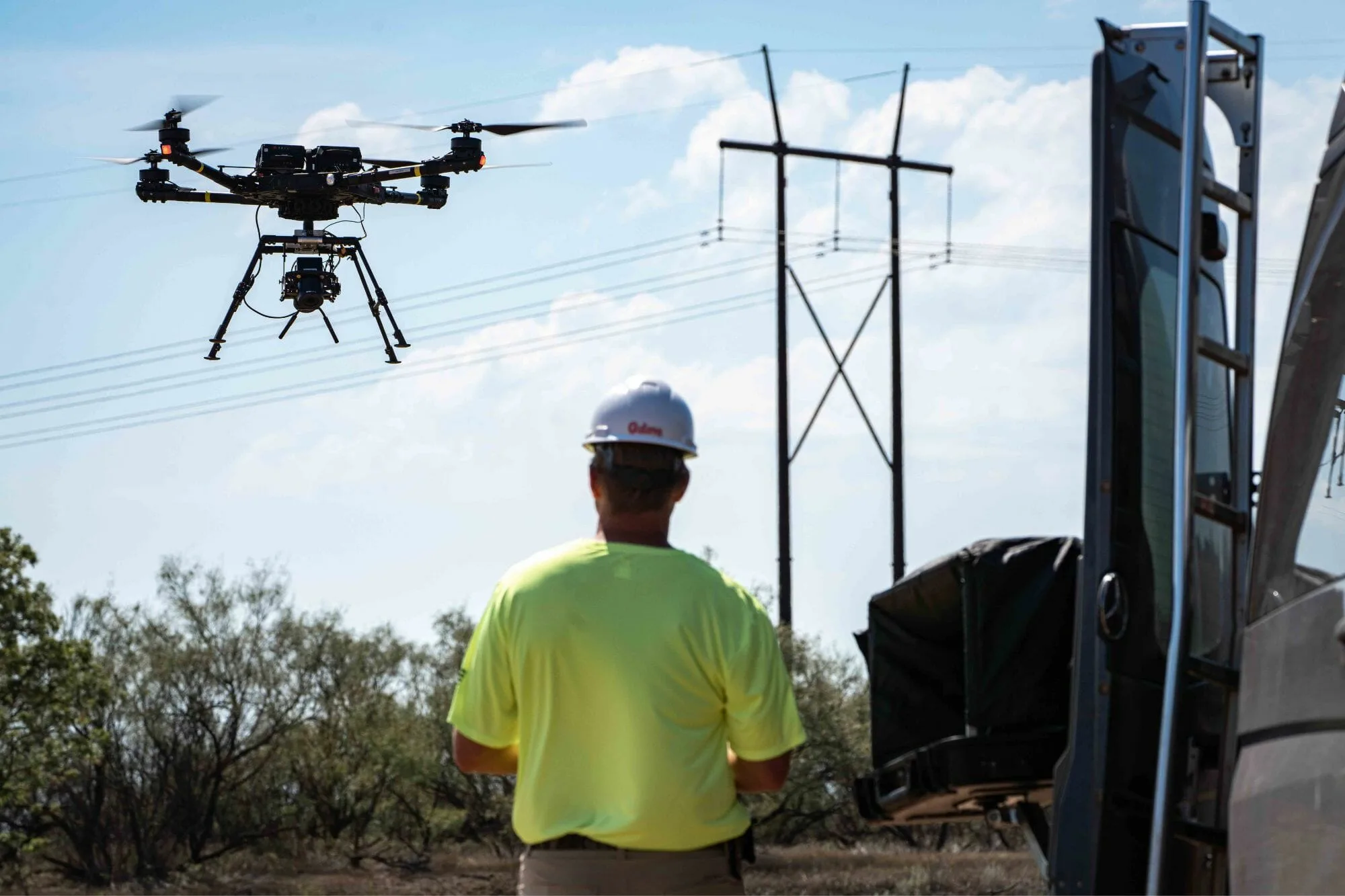
- BVLOS flying inspected over
in a single day
The new age of powerline inspections.
When working with utilities on their infrastructure inspections, we are constantly being reminded of the immense challenges that modernization, digitalization and huge expansion poses for utilities. And we are not claiming that we can solve all of these challenges on our own, but virtual inspections can support the energy transition and is aligned with the expectations of the new revolution when it is done right.
In a recent study with Xcel Energy, virtual inspections found 60% more defects than foot patrol, a staggering result that underlines the value of complementing traditional inspection methods with new technologies and methodologies. For the virtual inspection in this study, the footage was captured primarily using state-of-the-art Phoenix Air Unmanned (PAU) drones (some by helicopter), deployed with advanced camera technology from Phase One to provide high-resolution imagery for Artificial Intelligence (AI)-assisted defect detection. The virtual inspection was conducted by EDM International utilizing eSmart Systems Grid Vision® solution.
Drones, or UAV’s (unmanned aerial vehicle, but for ease– let’s just call them drones) are the latest addition to the air space. These smaller, unmanned air crafts carry huge potential, especially when it comes to infrastructure inspections.
- With their size, drones can easily fly closer to the assets without putting a human in harms way.
- Drones are also way more sustainable than helicopters, both in carbon footprint and cost of flying.
- The imagery captured by these types of drones are ideal to use in AI-assisted virtual inspections, as they can fly closer and capture high resolution imagery.
- The accuracy of the AI will also improve significantly when the images are of high quality, and therefore save time and money for the utility.
Today’s regulatory landscape.
Another critical difference that sets drones apart from their bigger, carbon-hungry cousins is the ability to fly beyond visual line of sight, or BVLOS for short. Flying BVLOS often requires applying for a waiver from the governmental entity of aviation with clear scope and operational descriptions.
The operator must present a clear safety case on how they will deconflict with both traffic in the skies and people on the ground. These safety mitigations may include:
- limiting the operating environment,
- use of electronic surveillance equipment to monitor the airspace,
- or keeping the drone close to the infrastructure that is being inspected.
All safety mitigations are outlined in a concept of operations (ConOps) – which is provided to the aviation authority along with operations manuals and safety management systems detailing the quality of the operator.
Tying this back to the fourth industrial revolution, proponents of using drones list the increased pressure on governments to change their current approach to fit the new possibilities that technology brings. The BVLOS flying of drones to capture infrastructure data is a perfect example of a shifting paradigm.
Utilities provide the ideal proving ground for advancing BVLOS drone operations under aviation regulations. The transmission line environment is defined as
“to include use of proximity to infrastructure as a mitigation to deconflict with manned aircraft traffic”
and routine inspections fall under public interest. As drone inspections scale to larger equipment, federal regulators require the operator to convey how the specific flight operation is in the interest of the public. With the ongoing electrification, and the ever-growing need for an uninterrupted delivery of power, the interest and acceptance has increased.
Following years of lessons learned and 13,000 inspection miles later, Phoenix Air Unmanned (PAU) recently secured a nationwide waiver for BVLOS drone inspection flights. The transmission line inspection waiver unlocks BVLOS operations for all utilities recognized by the US Department of Energy, providing huge value to increase the cost-efficiency of infrastructure inspections.
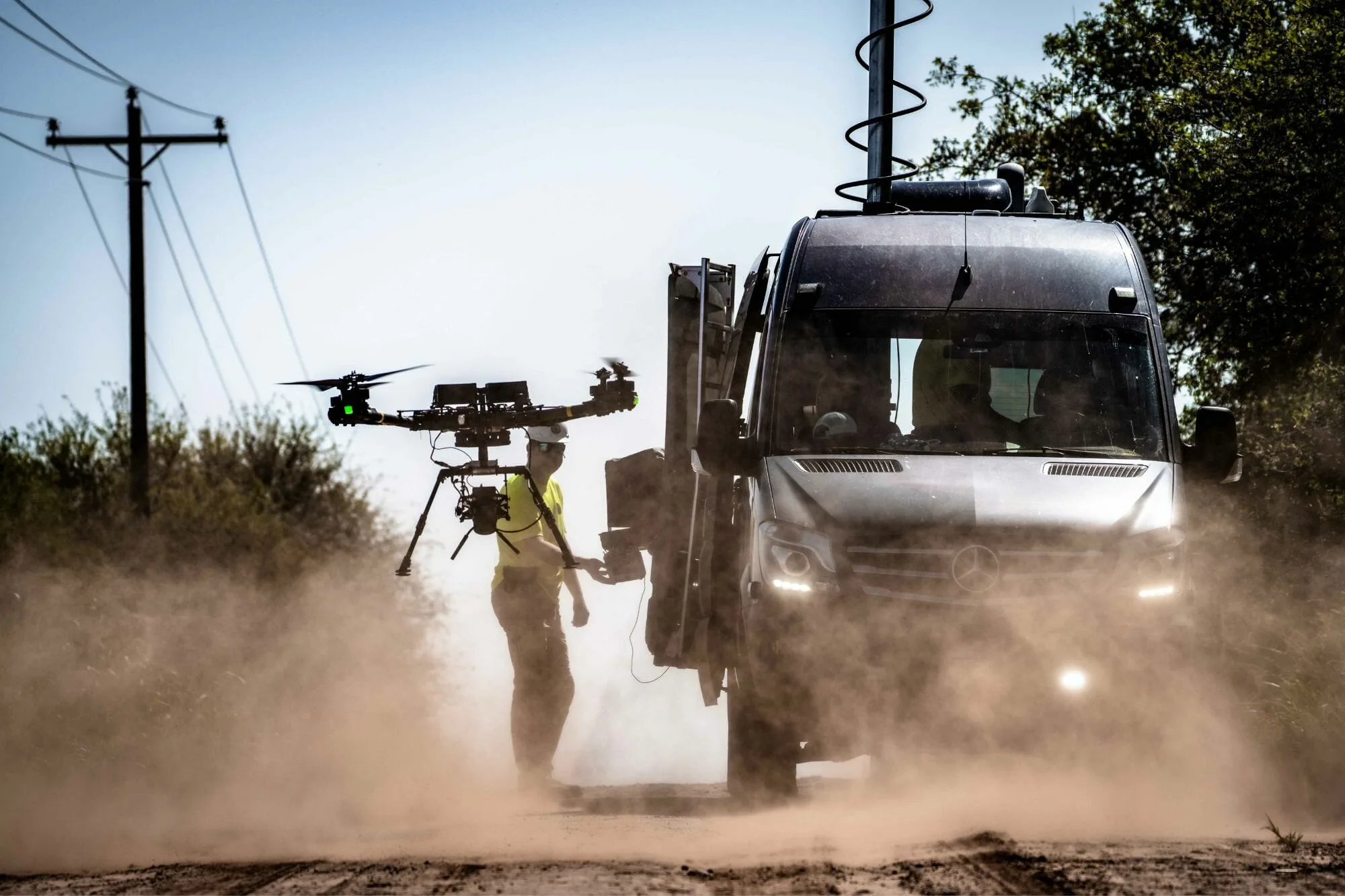
in the cost of drone data acquisition
It all started with five miles.
In 2015, Xcel Energy sanctioned a five-mile proof of concept transmission line inspection using drones. Limited by site access, weather, and shortened flight distances, they kept the unmanned aircraft within visual line of sight, the field crew took two and a half days to inspect five miles. Traditional foot patrol methods would have completed the inspection in a single day, underlining that something needed to change to increase the efficiency.
Today, under the BVLOS inspection authorization, the same five-mile stretch piloted by Xcel Energy in 2015 can be inspected in one single flight. For PAU, the distance per flight has grown to ten miles with field crews averaging 45 miles of inspections per day. In July 2020, a flight team inspected over 120 miles in western Minnesota in a single day. The area provided ideal conditions for launch and recovery access, aircraft command and control link, and met all the criteria presented in the safety case to fly extended flight lengths.
Changing the regulatory landscape.
As BVLOS operations have scaled, the cost per mile for acquisition has plummeted. Initial authorizations from regulators required visual observers in a “daisy-chain” configuration to keep watch of the skies when the unmanned aircraft was out of view of the pilot. Additional personnel along the route of flight provided little economic value for drone inspections. Today, the PAU BVLOS waiver authorizes the use of a single “Electronic Observer” monitoring airspace for the pilot. Removal of visual observers and the extension of flight lengths by no longer accounting for visual observer viewing locations has led to a 46% reduction in the cost of drone data acquisition.
In 2016, 14 CFR Part 107 was introduced by the Federal Aviation Administration for commercial operations of unmanned aircraft. The rule limited operators to less than 55 pounds total gross weight. The future of drone inspections is pairing BVLOS inspections flights with aircraft that exceed the 55-pound weight limit. An increase in weight will mean an increase in capability to include flying farther with multiple inspection sensors, driving the efficiency and financial gains even further than before and provides utilities the ability to gather high-resolution RGB imagery as well as LiDAR and infrared at the same time.
Some companies – including PAU – are operating larger aircraft outside of the bounds of Part 107. In 2023, the SwissDrones SDO 50 was put into service for powerline inspections. The aircraft flies for two hours at a maximum takeoff weight of 192 pounds – carrying a suite of sensors such as high-resolution inspection cameras, LiDAR, and infrared and near-infrared cameras. Regulators recognize the need for larger aircraft operating in the National Airspace System and are working towards a new set of rules to accommodate these systems. While larger aircraft can be operated under exemptions today, rules are still years away from going into effect, but every journey starts with one step (or five miles of transmission line).
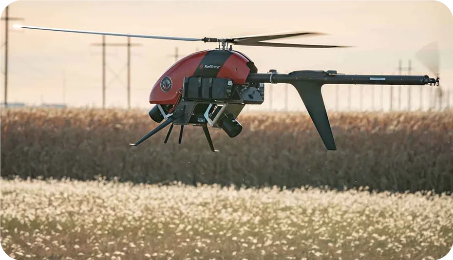
Scalable BVLOS powerline inspections via drone are available now. The foundation is being set by industry leaders who bring aviation experience when seeking approval from regulatory authorities. Operational history and use cases provided by the utility industry – paired with the transmission line operating environment – are under review by regulators. BVLOS rule making will eventually go into effect and the utility industry will be the first to benefit on a wide scale – long before commercial package delivery by drone is common (but we are looking forward to that too!).
Concluding thoughts.
The increased efficiency and financial gains from being able to acquire multiple data sources from one single flight provides a huge step towards grid digitalization and modernization. For virtual inspections to make the high returns that utilities are expecting, they need to consider the holistic inspection process and beyond, not all technologies and methodologies will deliver the same results. eSmart Systems understands the importance of creating great partnerships for our customers, to ensure our AI-assisted software can help utilities detect and identify the smallest defects on their assets, safely behind their desks and that the data captured can be utilized beyond the inspection. We believe in end-to-end solutions for infrastructure inspections, and we are happy to partner with Phoenix Air Unmanned to lead the way for utilities in the new era of inspections.
Contact us today and see how Grid Vision is transforming the way the world’s leading energy providers inspect and maintain critical infrastructure.
Our approach to AI-assisted virtual inspections is different. We have an asset centric approach to all of our solutions and build your image-based digital asset while you inspect as we know that data can support grid owners in their operations.
What is an image-based digital asset?
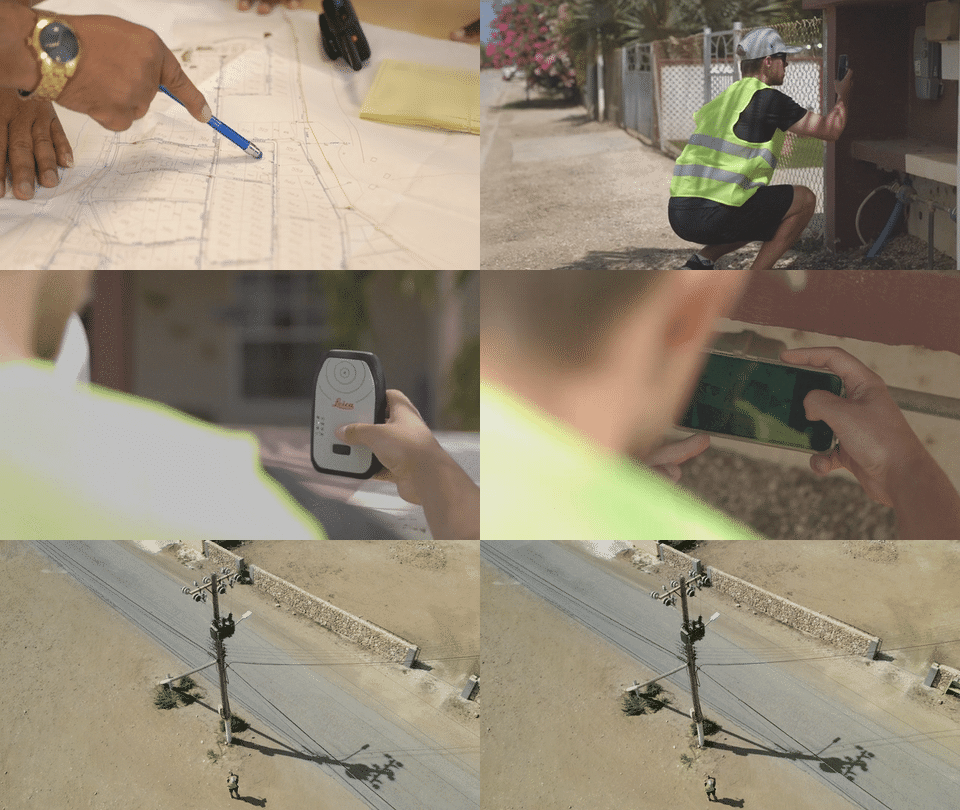
This is a digital representation of your physical grid linking your asset to your asset data, inspection data, images, meta data and grid topology.
Why would you need this data?
You may not have easy access to this image-based data today in your core IT systems. This data gives you another dimension of insight into your physical grid, the mechanical state of your grid through structured and tagged photos linked to inspection data, grid topology, meta data and a clear audit trail.
We hear from utilities that images taken of their grid by field crew is often not tagged, unstructured, not linked to an asset and difficult to access. If there are images, they are on a USB stick somewhere, on someone’s mobile phone or in a database that takes ages to load.
What value can an image-based digital asset give you?
From working with 50+ utilities globally we have seen our customers utilize the image-based digital asset in Grid Vision® in various ways and have summarized the top 10 common use cases below:
1. Improved capital planning
Our customers have now based their investment plans on accurate asset data and risk. Supporting them to prioritize their capital planning.
2. Decreased unplanned outage time
Utilizing Grid Vision as part of the outage management process to check the impacted assets and then plan the correct tools and expertise before going on site has seen our customers decrease CAIDI by 28% (43 mins).
3. Identifying common vulnerabilities
Our customers have saved hours from eliminating field visits by identifying assets at risk within Grid Vision at a desk within hours instead of days.
4. Supporting emergency maintenance
Providing Grid Vision to emergency response teams to check for structure types before sending out the crew to the field has saved our customers time and shortened time to restore grid faults.
5. Wildfire mitigation
Multiple customers are using Grid Vision to identify assets at risk from wildfire within hours by searching for components at risk at a desk and providing the visual data to field crews to go and fix.
6. Supporting regulatory reporting and major incidents
Our customers are using Grid Vision to confirm the state of an asset before an incident for root cause analysis and regulatory reporting.
7. Improving situational awareness and business decision
Our customers are using Grid Vision in virtual meetings with leaders to demonstrate challenges with projects.
8. Maintenance & planning
Grid Vision is used by maintenance teams to identify inventory, materials, skills, right of way before going on site.
9. Siting land rights
For new builds, our customers are checking Grid Vision to confirm any siting land rights for new projects. One of our customers identified an undocumented family cemetery on a potential new substation site.
10. Maintenance strategy
Grid Vision is used to support maintenance strategies, one of our customers identified assets failing before end of design life through Grid Vision. This insight helped them to re-prioritize their maintenance strategy to avoid unplanned asset failures.
By leveraging Grid Vision’s image-based digital asset, our customers are unlocking multiple core use cases and saving their teams time, improving safety, reducing costs across multiple departments and improving grid resiliency.
We do more than provide virtual inspections, we start with the asset itself and link the data that is needed to support your asset management processes.
Thinking of making the transition? Contact us today to start your journey.
- Inspection as a Service program to deliver full virtual inspection of AllgäuNetz’s distribution network.
- Virtual inspection supported by Artificial Intelligence.
AllgäuNetz the Distribution System Operator in southern Allgäu, Germany is partnering with eSmart Systems to transition their infrastructure inspection from manual to virtual inspection supported by Artificial Intelligence. This move is to emphasize AllgäuNetz’s strategy of integrating more renewables and expanding their intelligent networks and digitalizing their assets and operations to support the energy transition and optimise a high level of security of supply to their customers.
We were very impressed with eSmart Systems approach and methodology to support our inspection needs. Through an initial pilot project, the high-quality accurate inspection results delivered within Grid Vision® provided valuable insights into our critical infrastructure. We are now thrilled to be rolling this out across our whole infrastructure.
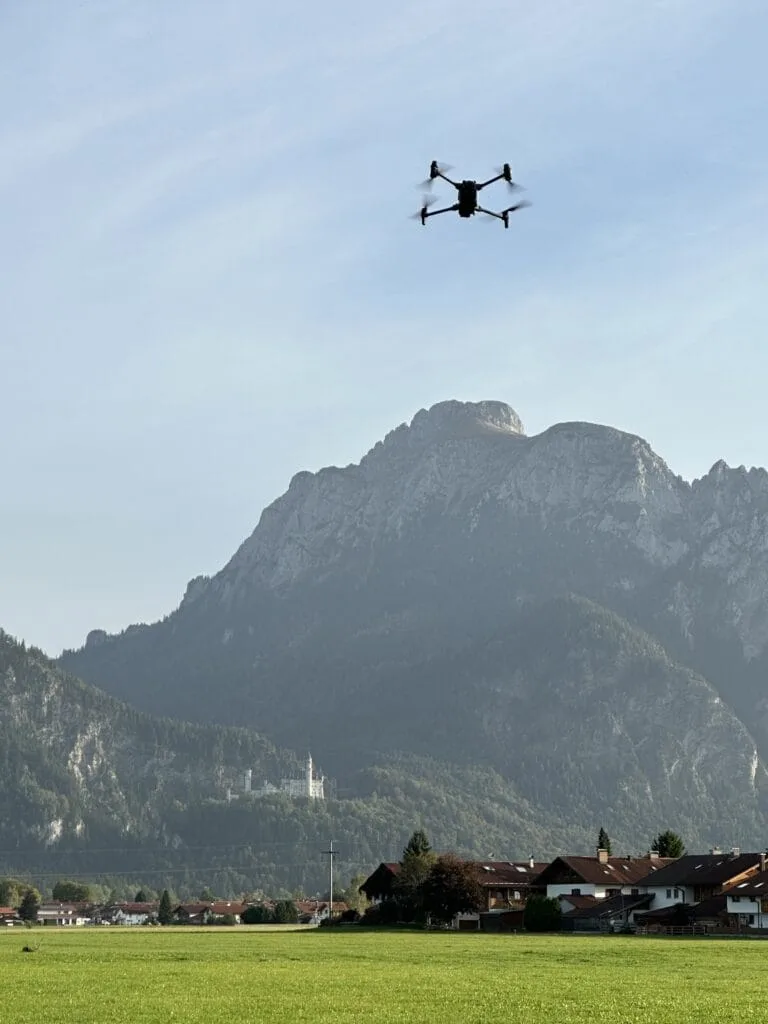
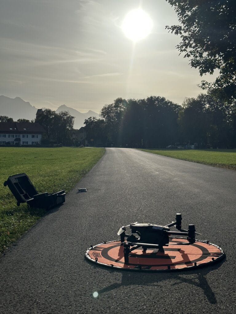
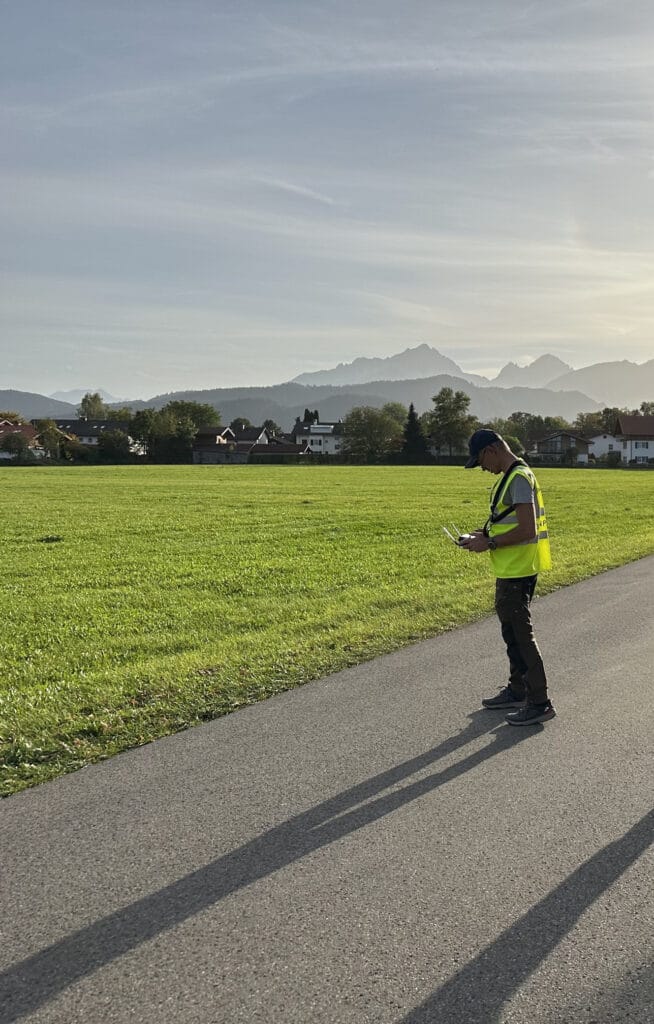
As part of this partnership eSmart Systems will provide the full end-to-end inspection solution from image capture with automated flight patterns and drones to the virtual inspection, which will provide safer, more accurate and efficient visual inspections and will optimize the inspection costs. The program will also build an image-based digital asset alongside the inspection which will support AllgäuNetz to focus on assets based on condition for maintenance and rebuilds.
Die Energiewirtschaft steht vor besonderen Herausforderungen wie der Reduzierung von Risiken in der Stromversorgung und der Verbesserung von Netzplanungsprozessen, um nur einige zu nennen. Repower schätzt die Vorteile von Grid Vision, um nicht nur Effizienzgewinne in unseren täglichen Inspektionsprozessen zu erzielen und eine höhere Qualität zu erreichen, sondern auch, um tiefere Einblicke in unsere Assets zu erhalten. Dies unterstützt uns bei der Verwaltung von mittel- und langfristigen Wartungsplänen und unserer Investitionsstrategie.
About AllgäuNetz GmbH & Co. KG
AllgäuNetz GmbH & Co. KG is the Distribution System Operator in southern Allgäu, Germany, supplying safe and secure electricity to 144,000 customers.
A safe and reliable power supply is an important basis for our society. AllgäuNetz GmbH & Co. KG, as a company belonging to Allgäuer Kraftwerke GmbH, Allgäuer Überlandwerk GmbH, Energiegenossenschaft eG Mittelberg, Energiebedarf Oberstdorf GmbH and Energiebedarf Oy-Kressen eG, consistently faces up to this responsibility.
With our employees, we are responsible for large parts of the power grid in southern Allgäu. The power grid in operation includes approximately 5,500 km of lines in an area of approximately 1,700 km².
Through the interaction of renewable energies, intelligent network expansion and operation as well as reliable support across the area, we ensure a high level of security of supply.
Together with our private customers, commercial businesses and the communities in southern Allgäu, we work daily on the changing energy landscape and implement the changes together in an innovative and goal-oriented manner.
About eSmart Systems
eSmart Systems is a leading provider of AI-powered solutions for the inspection and maintenance of critical infrastructure. With our software solution, Grid Vision® we revolutionize how utility companies operate and maintain their transmission and distribution networks. We support utilities globally to reduce inspection costs, make inspections safer, improve the quality of asset data and prolong asset life. eSmart Systems has more than 20 years of international experience in establishing and operating knowledge-based, leading IT and energy-related companies targeting global markets.
